
Breathless Ascend
A Visual story about my solo cycling expedition on the highest motorable mountain pass in the world.
Manali - Leh - Khardungla, India
About the project
Manali - Leh route is one of those Highways in the world which offers almost everything nature has to offer to an adventure lover. Open for four to six months in a year is 480 km long.
The visualization shows my solo cycling expedition from Manali to Leh and Khardung La crossing 5 high altitude mountain passes including Tanglang La so called second highest pass and Khardung La the highest pass in the world. The visualisation is data storytelling mapping my experience and emotional journey. The readers get first hand information to plan their own journey.
Individual Documentation, Data collection, Information design, Visual design.
Duration 3 Weeks
A0 Size Visualisation
Objective
Information Guide
Information on where a traveler can look for food, stay, mobile network, altitude gain, oxygen level, regions with snow cut roads, water crossings
Planning & decision making
Guide people to make decisions according to individual capabilities by understanding the route challenges and facilities available on the route
Journey at glance
Sharing my experience at a glance for the riders to get an overall picture of the journey
Motivate solo adventurers
Inspire people to take solo adventure and travel experiences
Visualisation Structure
The visualisation is divided into 4 layers

Sectional Elevation / Locations & Facilites
The section through the route shows the gain of altitude at in between locations and the graph of oxygen level at that location(Accurate route section is derived from Google Earth path section). It shows how much calories I burnt which was recorded on Strava application. Facilities are available at the location at the bottom of the section.
It also shows my state of mind and emotional journey.

Stagewise Ride Analysis
Daily data was collected on the Strava application and noted in my travel diary. The visualization shows the time of ride as well as time spent walking, climate and interesting moments of that day with respect to the time.

Route Map
The section does not show the exact route and surrounding which is very crucial information to ride on the highway. Information like check posts, water passes, landslides, lakes, and hairpin bends on the roads can only be shown on a route map.

Insights
During the course of visualisation, certain interesting insights came forth during data analysis phase.

The route with higher slopes & altitude took longer ride time and my body
gradually got acclimatised to the conditions with a rise in performance level.
Expedition Documentation
Methods of collecting data
Quantitative and Qualitative Data
Strava
Cycling Applications to track distance travelled, time of riding, calories burnt, speed and elevation gain

Google Earth
Distance, Geography and altitude elevational section

Vlog
Travel documentary and daily travel updates recorded on Gopro and point & shoot cameras

Travel Diary
A daily travel dairy on the journey to capture daily events as well as weather data.
Data Analysis
Data was plotted, explored, and organised in MS Excel and Tableau


Visual Language
The shapes were inspired from the bike parts.

Daylight
Inspired from the disk brake of a bike. Each cut on the periphery of the disc represents one hour

Hours of Riding
Every golden chain link represents one hour spent cycling and each link gives the minutes of riding

Start Time
Shifter on bike is used to represent start of the day

Stop Point
Stop of the days ride is indicated by disc brake pads on the bike
The Journey
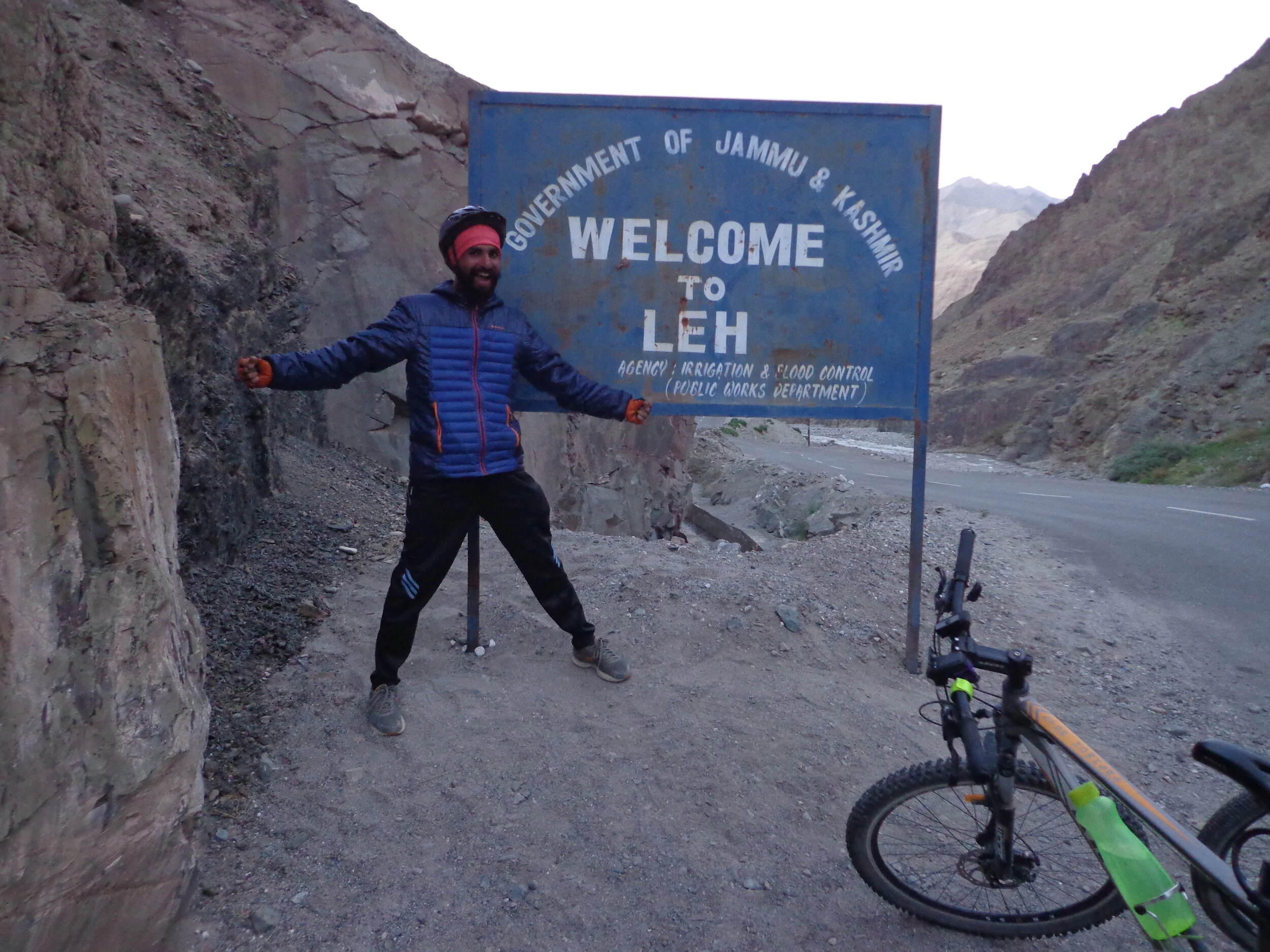
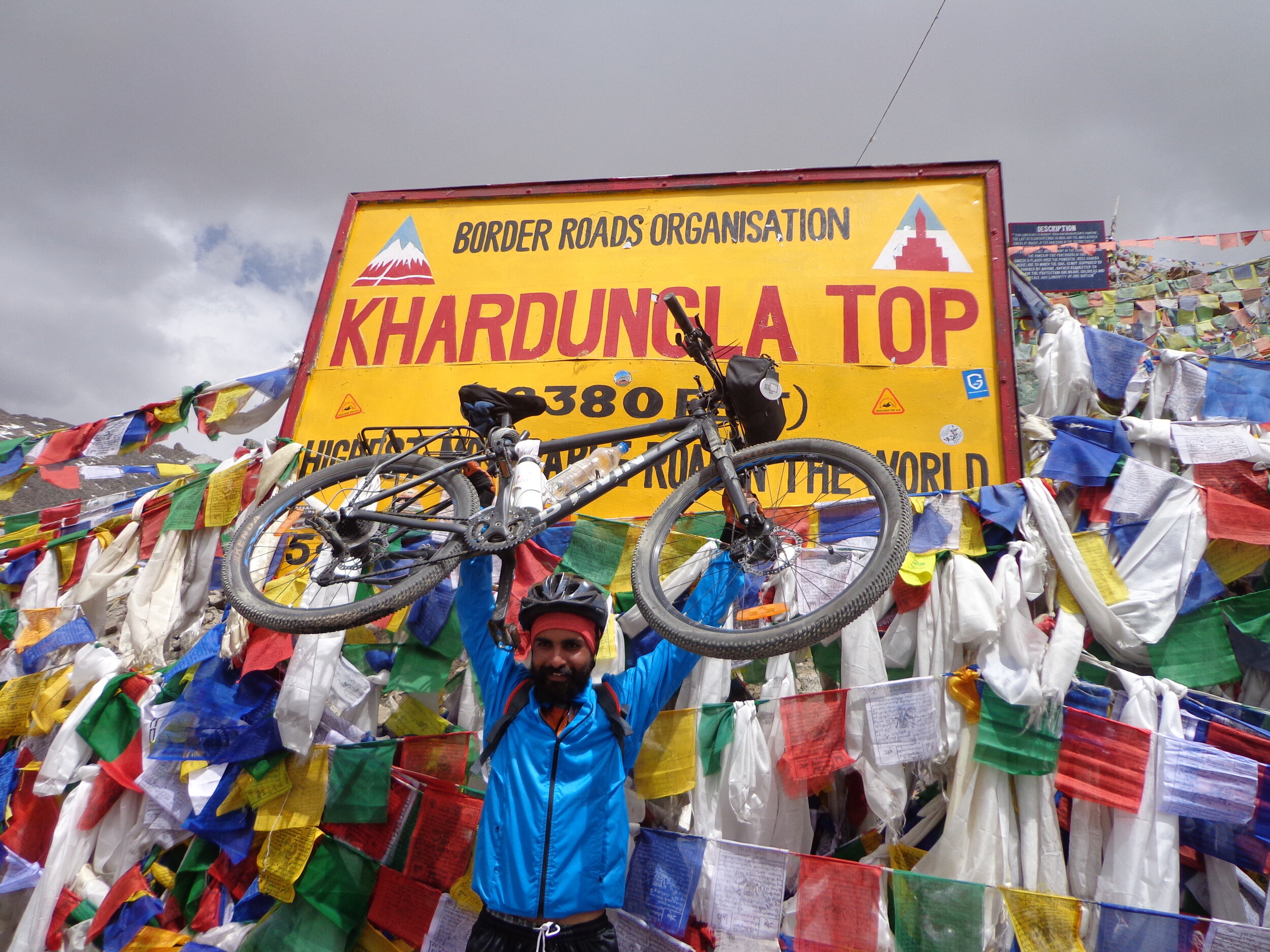
Photo Gallery


Short Film - The Breathless Ascend
I always wanted to attempt a self-supported adventure that challenges my limits. I decided to do something out of my comfort zone, feel that adrenaline rush, disconnect from routine and reconnect with the wilderness. Manali - Leh - Khardungla Highway, India access point to the high mountain passes in the Himalayas and one of the highest in the world reaching up to 5359 m (17,582ft) where the air contains only half of the usual amount of oxygen. The route presents challenges of high altitude, freezing temperatures, uncertain weather, and long stretches of winding roads.
More travel stories and photos on my Instagram handle